• Skip to primary navigation
  • Skip to content
  • Skip to primary sidebar
  • Skip to footer

SkinTrack

  • Lightest Gear
    • Skis
    • Boots
    • Bindings
    • Skins
    • Packs
  • Skimo Training
    • Training Plans + Skimo Manual
    • Transitions Videos
  • Facebook
  • Instagram

Trip Reports & Conditions

Chasing an old dream at Duffey: skiing Joffre, Matier, Slalok in 5h 58min

May 21, 2012 By Stano Faban 3 Comments

I believe everyone has their mountain dream missions whether it be a ski traverse with friends, a steep line descent, or a new climbing route. Everyone has dreams and everyone gets inspired.
One of mine came to life when I first skied off Mount Matier about 10 years ago. That evening, I and Miki (good friend of mine) imagined skiing the summits of Joffre, Matier, Spetch and Slalok in a day. We planned to have a camp on Matier glacier to allow an early start and a place to return for a nice dinner.
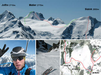
We never went for it.
And in the years since I only skied the N ridge of Matier and Aussie Couloir on Joffre. I never summited or skied Slalok, nor skied the NW face on Matier.
But as time passed the dream was still there, however, taking on a different shape.
I realized that if we ski Slalok then it has to be its north face, otherwise, there is no point.
Then as we progressed it became clear it would be possible to do it all in one big day – starting at Cerise Creek, finishing at Joffre Lakes.
Finally, in the past 3 years, I twisted the dream further as I became more inspired by what ski mountaineering racing was teaching me and seeing how our Canadian skimo racing team was progressing. More came from John Baldwin’s exploratory spirit, Kilian Jornet’s running quests and Ueli Steck’s speed climbs.
The dream was the original but I wondered how fast it could be done.
And an integral part for me is always to do such missions in an unassisted way – you carry all you need, otherwise, there is no point.

The route

At the end I decided to leave out Mt Spetch. Its north face is nice and around 40 degrees but it is only 200m high, and the whole peak is kind of small within its spectacular surroundings.
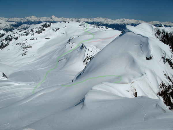
The final route became – start at Cerise Creek, summit Joffre, ski Aussie, summit Matier, ski its NW face, summit Slalok, ski its N face, finish at Lower Joffre Lk.
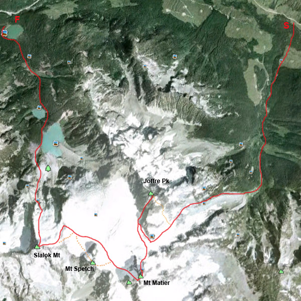
Duffey Lake speed traverse map - Joffre, Matier, Slalok
A more aesthetic link-up is possible and maybe even faster - climb Joffre via its SE face/ramp, and climb Slalok via its small and steep E face. And include Spetch in the loop 😉

The challenge

The most fun but somewhat intimidating part of the whole thing was that I would be skiing the NW face of Matier and the N face of Slalok for the very first time. I liked the unknown element.
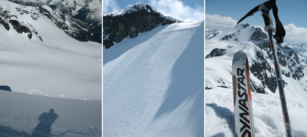
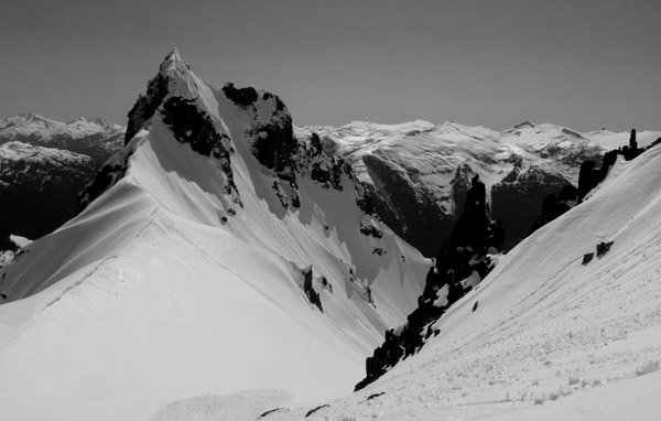
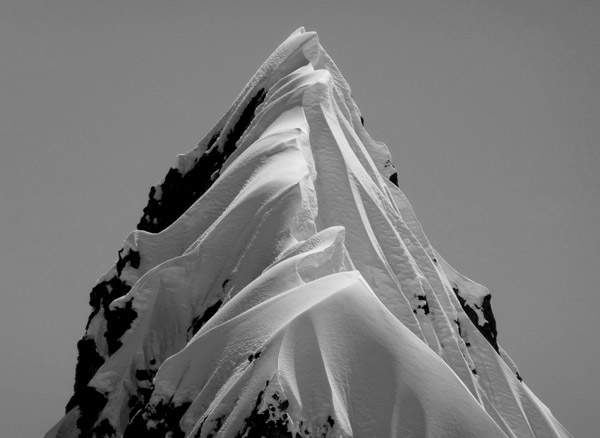
Safety wise, the worst part would be down climbing Matier summit and to ski its NW face. Once there it felt natural but I made only precise turns as the face was hard frozen. I have never seen so much snow on Matier's summit ridge (which helped), and I didn't expect to skin up right over the summit rock of Slalok (right).

Planning

For bigger speed missions I like to plan well because I hate coming out short-handed. By that I mean either not being able to pull it off or not being able to go as fast as I would like to.
I didn’t know whether it was still possible this year. I didn’t know anything about current snow pack and temps as I have not skied at Duffey Lake since early February. So I dug up some recent weather stats, and started to follow temps and weather about 10 days prior.
I knew data knowledge is good but a personal experience would be the best. On May 13th I went up Cayoosh Mt to get a feel for snowpack, and what temps and sun were doing. Also, that I could snap photos of Slalok’s N face so I could study where is the safest to ski it should the day be very warm.
Final piece of my puzzle have not come together though – a ski partner. However, there was no time to stress about it as it fell through at a late stage and the right conditions (snow, day temps, weather, desire…) were/are running out.
I decided to go through with it solo as I did in the past when I couldn’t agree on conditions with a friend over a speedy Spearhead Traverse mission.

Stano on Joffre, Matier, Slalok
Peace and quite up high. Standing on top of all three within about 2h.

Some facts and the day’s route

I started a bit after 6am (May19) from the bridge over the first creek below the Duffey Lk road at Cerise Creek. The start gave my mission “a bigger life perspective” as there was no bridge/log over the second creek. But quickly I managed to find a log crossing it about 100m down.
In 5h 58min I finished on the bridge over the creek that drains the Lower Joffre Lk, after some summer trail and forest navigating as all Joffre Lakes were unfrozen on their perimeter and couldn’t be skied over.
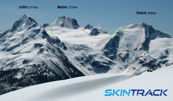
Joffre, Matier, Slalok from Cayoohs
I snapped this photo a week earlier from the Armchair Gl below Cayoosh.
All in all, my watch measured 2520m of climbing and descending (the start and finish happen to be at almost the same elevation). Fresh hard tracks all day long, up and down.
3 summits, 3 classic descents. What a day 🙂

Further inspiration

There was one thing that struck me during the day – I crampon boot-packed from the bottom of Aussie to the summit of Joffre in about 35min (400m), and I feel couple of weeks behind my fastest this season. That means that someone much more skilled can surely boot it up in 20-25, maybe Steck even faster, that would be something to watch!
Here are some route points and times that further inspire me and can serve anyone as a reference if they want to repeat it:

  1. Start point – bridge at Cerise Cr below the “parking lot” at Duffey Lk road
  2. Up the Cerise Cr drainage, up the right moraine (close to the hut)
  3. Up Anniversary Gl to the col [reached in about 2h]
  4. Ski down to the bottom of Aussie Couloir
  5. Crampon up Aussie and to the summit of Joffre Peak [2h 45min]
  6. Ski off Joffre summit and down Aussie [3h 15min]
  7. Skin and crampon up the North ridge and over the summit of Matier [4h]
  8. Down climb to the top of Matier’s NW face, ski it and down the Matier Gl
  9. Skin up (with a short boot-pack) over Slalok’s Northerly rib to its summit [5h]
  10. Ski down the Slalok’s North face to Upper Joffre Lk
  11. Ski down to Lower Joffre Lakes mostly via the summer trail

After getting it done I believe I can do it quite faster, and it likely could be done under 4h30 by the fastest skimo racing Euros. But not while going solo, skiing two first time lines and visiting new places. That only could have happened in a more balanced way 🙂
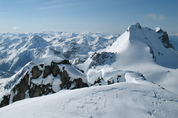
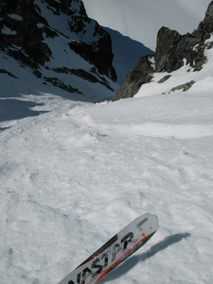
Matier from Joffre
Awesome morning atmosphere on top of Joffre, and scanning the planned route over on Matier.
Skiing Aussie Couloir
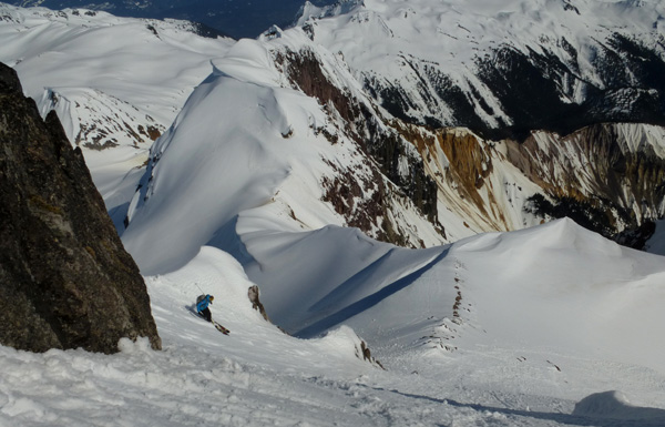
Skiing in Aussie was tough – very hard snow as the sun hit its top half only 10min before I started skiing, and bunch of funnels through the middle in the lower half.
Aussie Couloir from Matier.
Looking back at Aussie. And so much snow on the summit of Matier.
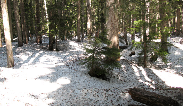
Joffre lakes forest.
And as all good Canadian traverses end - with a tree skate-ski slalom over pine needles and creeks 🙂

Filed Under: Trip Reports & Conditions Tagged With: Duffey Lake, Mount Joffre, Mount Matier, Slalok Mountain, Stano Faban

Mount Cayley TR: long day, spring skiing, gong show, and supernatural Thunderbird

May 15, 2012 By Stano Faban 2 Comments

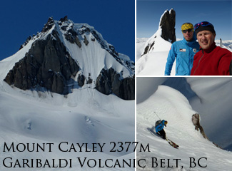
Have you ever heard of Mount Cayley? Because I haven’t until two weeks ago.
Mt. Cayley is a stratovolcano (http://en.wikipedia.org/wiki/Mount_Cayley) in the Garibaldi Volcanic Belt that managed to elude my good friend Tomas on two previous attempts.
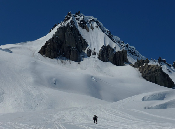
Mount Cayley, British ColumbiaIt’s not a high mountain, only 2377m, but it’s far away enough that lots of things have time to happen before you even reach the foot of it – weather goes bad, equipment fails, motivation fades…
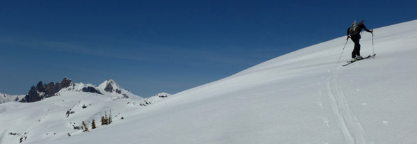
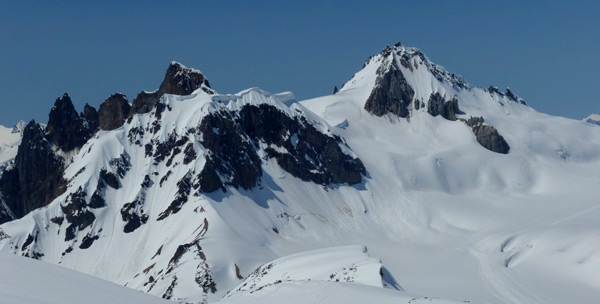
According to the Squamish natives Mt. Cayley is called “Landing Place of the Thunderbird”, and that the mountain have been burnt black by the supernatural Thunderbird’s lightning – bird of power and strength.
I didn’t know this when going up there but now the whole trip borders legendary missions.

7h in, 3h back, great skiing – May 12, 2012

I don’t think anyone but we goes to ski Cayley on a day trip. Even Tomas on two previous occasions would try it only as a part of multi-day trip.
The day before he said “it is 8k one way”. Looked more to me. We didn’t to plan to move fast but starting at 9am in mid-May is a bit pushing it, and I was on Tomas the whole day for being too lazy to wake up earlier.
At the end his argument was proven right: “we could ski corn at 10am when SE face starts melting…..or we could ski it at 5pm as it starts refreezing.” Love your friends and be happy, I guess. 🙂
Thanks to lots of snow this year we had to park our car quite far out, at around 900m. And the day began.

About 15min away from Brandywine Mt. Cayley shows up looking super far.
See route map and route photos at the very end.
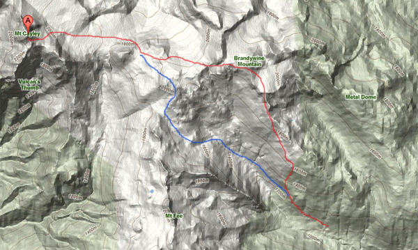
First, we conquered a boring forest road full of snowmobile tracks by obsessing about skiing Mt. Fee. Then to avoid a narrow valley bottom, smeared by avalanches, we gained the SE shoulder that took us to Brandywine Mountain. From there we went up-and-down-and-traversing couple of shoulder bumps that run W of Brandywine, finally reaching a big glacier below Cayley that connects to the Powder Mountain icefield on its southern end.
By traversing and following small humps to we reached the glacier below Cayley.
Then we skinned up a NE slope that brought us to SE ridge of Cayley. A quick boot-pack up the SE face, hop over the SW ridge and up the W face to the summit.
Highway to Hell - despite heavy snowmobile traffic the place still has its atmosphere. Plus the guys were careful when passing by. We met/saw only about 20 of them the whole day.
At 4pm, after 7h, we were standing in the middle of of it all, and quite freakin far from the car. 😉
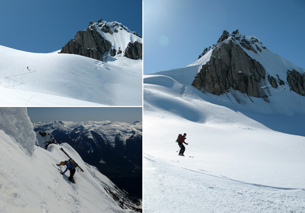
The skiing was excellent despite my worries over a very warm day. It was getting a bit mushy but still on the good side. We skied right off the cornice between the two summit spears following our way up.
After 2550m of climbing and skiing  we were back at the car around 7pm.
It’s great to have a friend that gets obsessed with peaks I don’t even know about.
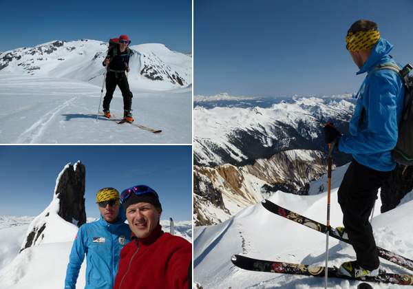
Clockwise from top-right: Tomas skinning with Brandywine far behind, eyeing a landing on SE face, on the "summit"
The NE face (55 degrees) got skied before and didn’t look super steep when we were going up around it. Even the conditions might have been right that day, however, sending down the big entrance cornice might have took out enough snow to make it un-skiable. Will face up to it one day.

Gong show

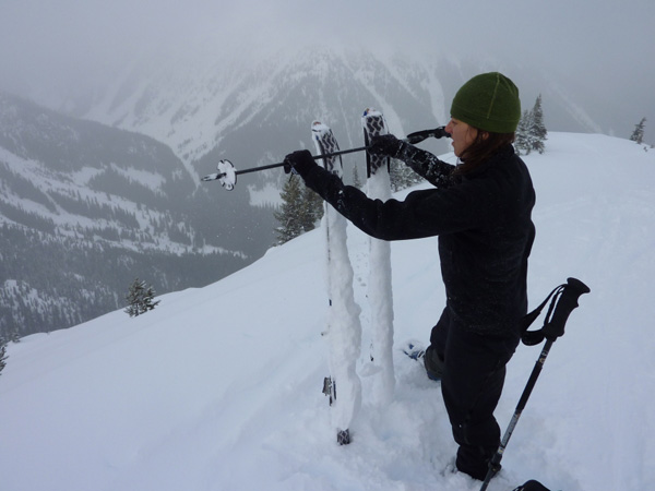
I think I was the gong show of the day. Always remember to check your bindings after you lend your skis. Mine were too big, so the first downhill and a traverse were without heels. Then a Swiss knife safe the day.
Also, it is worth buying a real map instead of looking at one on a camera, especially, when a photo of that map was taken off a computer screen. Tomas eh…
Day’s score:
Stano -1 + Tomas -1 = 100% day

Route map and photos

Red shows our way in. On the way back we went with the blue variation.
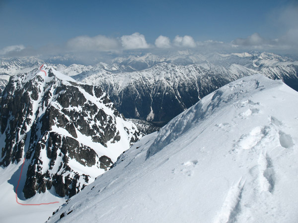
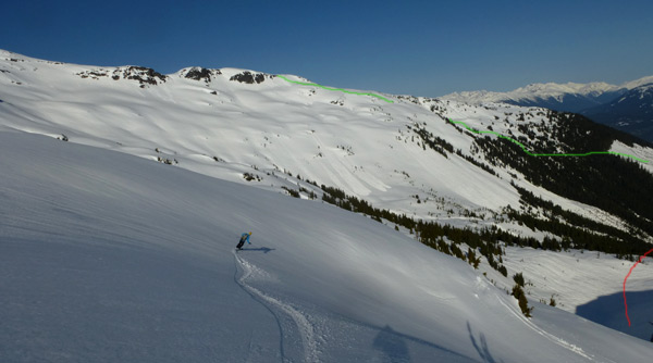
Green shows gaining the SE Brandywine shoulder. Red is a descent on the way back.
As seen from SE ridge of Cayley: green shows way in, on way back we retraced it, then went red.

Cool environments


More than half of the photos in this TR are from Tomas Cernicka. If you want to copy any off this page please contact me.

Cayoosh Mountain – the next day

If anyone is heading up here are the subjective facts (from May 13, 2012):
Since I wanted to check out conditions on Duffey Lake I headed up to Pemberton in the evening. Slept in the car and went up to Cayoosh Pass for a solo mission the next day.
I did only a quick up-and-down the mountain as it was supposed to be very warm even up high. And it was, but I was skiing off the summit around 11am. The top 150m was quite slushy with sluffing but below that great skiing.
Surprisingly, in the whole Duffey Lk area the slopes looked quite pristine, not many signs of avalanching. That’s likely due to only very recent warm days, otherwise, around this time you can see some huge slides over there.

Saxifrage looking good. (From the summit of Cayoosh.)
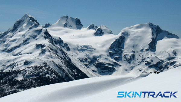
From the Armchair Glacier, looking at Joffre (left), Matier and Slalok.

Filed Under: Trip Reports & Conditions Tagged With: Brandywine, Mount Cayley, Stano Faban

Grand Teton: adventures are essential for skimo training… because every journey counts

January 26, 2012 By Stano Faban Leave a Comment

This is a second article submitted by Melanie Bernier – an elite skimo racer and a pillar member of the Canadian National Ski Mountaineering Team. Read her first article here – skimo racing experiences from Jackson Hole and Grand Targhee.
At 3am on January 14 two alarms went off in our host attic. After 8 nights of sleeping in our small camper we finally gave in to a short but restful night in a real bed, the reason being a grand ski plan for the day.
With a high-pressure system hitting the Tetons, our nice local tour guides and friends decided that it would be a good idea to climb the Grand Teton – one of the most dramatic mountains in the South Rockies.

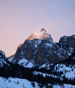
Grand Teton winter sunrise, skinning in the morning.
The magic of the day begins.
Still sleeping, we literally jumped in our prepared clothes, swallowed our pre-cooked breakfast and jumped in Nathan’s big diesel truck. On the way we pick upped Zahan and headed to Teton National Park.
Armed with our headlamp, heavy backpacks but light race gear, we were skinning the sleeping forest just before 5am. We were making good time traversing the flats and zigzagging in the trees to gain the meadows.
Approaching the Grand.
At the break of dawn, we were standing just below the headwall looking up at both the Grand and the Middle Teton. The breathtaking dramatic scenery and multiple ski couloirs were highlighted by the ever so stunning sunrise.
As we gained a plateau, below the Lower Saddle, the winds started to pick up. They were only breezes compared to what was waiting for us higher up.
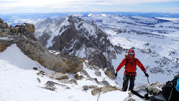
Winter scramble up Grand Teton.As we reached the col where climbing gear was waiting for us we found out that crampons were missing and so we had to do with what we had.
By that point, we were barely able to stand due to ever so increasing winds. We took a little break to plan and to put on all warm layers we had to keep warm.
We started our trek (without skis) along the ridge leading to Owen Spalding route. We had to use all of our strength to stay up right fighting consistent 75-100 miles/hour winds.
Then a simple walk on rocky ridge changed to scrambling and boot packing on supportive wind packed snow.
We gave ourselves a time limit to reach the Upper Saddle because we knew it would be very difficult to get any higher safely because of the winds.
At this point, both Nathan and Zahan, having climbed “The Grand” multiple times, admitted that they have never seen winds to this magnitude up there.
We finally turned back at the Balcony at around 13000 feet, just below the Upper Saddle. From there, we climbed down and fought the winds all the way to the Lower Saddle where we retrieved our skis. Thankfully, we anchored them good enough to find them there.
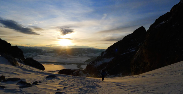
Winter sunset over Grand Teton.We skied down in very strong wind gusts but beautiful sunset. Back to the flats, we crossed the frozen lake and looked back at the only peak standing in the lowering sunlight: The Grand.
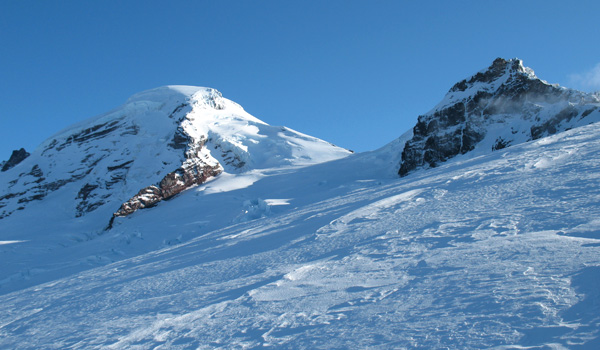
We may have not made it to the top that day but we sure discovered an area where we would like to return to. Some other day we will stand on the summit… today wasn’t it. In this case it was the journey that made the day incredibly special.
A big Thanks goes to Nathan and Zahan for such a great day!
This was one of the highlights of two weeks of exploring Jackson and its surrounding areas. Now back on the road, time for some Ski Mountaineering Racing in Colorado!
Andrew bootpacks up Grand Teton.

Filed Under: Trip Reports & Conditions Tagged With: Andrew McNab, Grand Teton, Melanie Bernier

Mount Baker, Cascade Mountains on Dec 10, 2011

December 10, 2011 By Stano Faban Leave a Comment

Long story short – Reiner and I did not summit even though that was the plan. It was possible and some other folks must have done it few days before as we found some footprints.
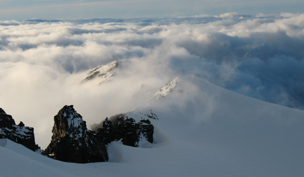
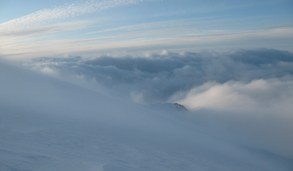
Overall a great trip that made us practice various mountaineering skills. As a bonus the changing clouds and December light created the most spectacular imagery I have ever seen on Mount Baker.
Access road
We drove to about 2km from the parking lot thanks to Reiner’s skill but otherwise were passed by surprised sledders once skinning. With Subaru or equivalent we would have been lucky to drive to about 4-5km from the parking lot.
Snow and glacier conditions
Everything was wind blasted from top to bottom. At some places it was super icy, whereas, at others a very hard wind slab has formed.
Glaciers are covered enough for a roped-up travel, nothing scary, easy to navigate. But in foggy conditions it can quickly turn into an epic.
Travel
Uphill required some technical-to-sketchy skinning even on low angle slopes. Skiing was not at its best but here and there some decent turns were possible – overall it was fun.
Roman Wall must be in almost unskiable conditions – likely sheer ice. We turned around at the Col which is at about 2750m as we were running out of time a bit and valley clouds started to foggy up the Coleman Glacier descent route.

Mount Baker
Looking good once we got above the clouds and out of the ice gullies on West side of Heliotrope Ridge.
Cool snow texture.
Our Coleman Glacier ascent/descent route.
Amazing show on Heliotrope Ridge. No admission charges either.
Every minute brought something new.
The journey certainly made up for the summit today 🙂

Filed Under: Trip Reports & Conditions

Canucks in Andorra: Culture shocks, race engines tune ups, big traverse plans

February 25, 2010 By Stano Faban 6 Comments

First of all, I would like to thank all the people that are supporting me and other Canadian team members in our efforts to represent Canada at the world skimo racing scene this season. Without you it would be very close to impossible. Thank you very much.

Atop the highest peak on the race course, from left - Alex Wigley, James Minifie, Stano Faban.
On February 19th, five members of the Canadian National Skimo Team boarded a plane headed to Europe.
The journey’s primary objectives are the World Ski Mounatineering Championships in Andorra, and a four day stage race in France – Pierra Menta. And learning…
Three of the five – James Minifie, Alex Wigley and I – switched a plane in London to eventually land in Barcelona.
Julie Matteau and Jeff Colvin continued to attend a skimo training camp in Sicily (Italy) where they joined other team members.
The travels were tiring, however, I felt a certain privilege to “visit” three Olympic cities in less than 13 hours:

  1. We flew from Vancouver BC where the 2010 Winter Olympics are in a full swing.
  2. Switched planes in London that will host the next Summer Olympics in 2012.
  3. And landed in Barcelona where Canada captured 7 gold, 4 silver and 7 bronze medals during the 1992 Summer Olympics.

Culture shocks

Liking the culture, not so much the civilization.
Living in Canada for almost 9 years now, and going back to Europe only occasionally past few years, I caught myself being somewhat depressed by seeing that humans managed to leave their mark at every spot over the old continent by now.

James bombing up the kids terrain park Bode Miller style.
Endless webs of chairlifts, roads climbing the most exposed terrain features and people fighting for every square inch made me to be thankful for the Canadian wilderness.
And then there was James, who lives up at Yukon’s White Horse, getting awestruck by not being able to see backcountry past the last chairlift. Simply, more and more chairlifts followed.
But all three of us sure like the food, architecture and the spontaneity with which people great everyday here. And yesterday, all turned a corner when we went to check out the individuals race course :).

Race engines tune ups

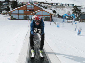
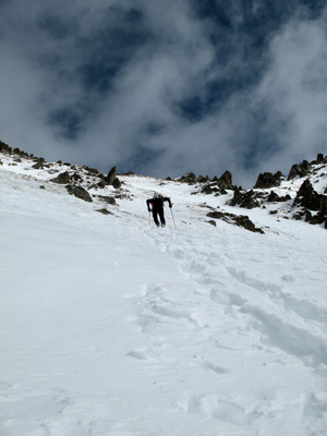
James heading up the boot pack that should be featured in the very last climb.
For the first two ski days we only attacked the ski runs right across the road from our hotel at Soldeu as jet lag and 9h time difference didn’t let us do any damage in the backcountry.
But yesterday, after a first full-night sleep, we caught a taxi ride up the valley to Grau Roig to check out the course for the World Championships’ individual race that will take place on Wednesday, March 3rd.
Once on skis, we were all shining with big smiles as we reached the real backcountry in just about 30min of skinning.
In the process we got passed by a couple of Spanish Team members that were practicing their furious stride frequency in Pierre Gignoux carbon boots.
However, they stopped for a moment to great us and once I recognized one of them (I met Manu Perez a couple of years ago at Whistler) they showed us the way and offered us to join them. Even though the offer was exciting we decided to stick to our acclimatization plans and let the fast deers run…and of course to break trail for us.
Few moments later we were treated to being past by Mireia Miro, top caliber female skimo racer, and one think became very clear – in Europe, even if you have carbon F1 boots you can look a like a tourist :).
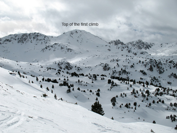
top-first-climb
95% of the individual race course is in the backcountry with avalanche debris covering couple spots of race course. Based on what we saw, it will be an amazing venue for a skimo race with lots of technical sections whether on the uphills or downhills.
» You can see more pictures from this day and the course at Alex’ Ski Theory blog.

Big traverse plans

Since I have yet to meet a Canadian that would look at a topo map without connecting glaciers, cols and ridges for possible traverses all three of us studied the map of Andorra at some point since leaving Barcelona.

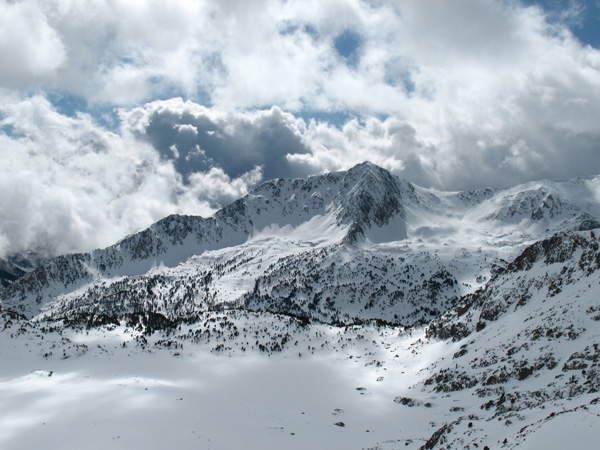
As long as you get away from lifts Andorran backcountry looks very nice. There is a nice hut by the lake - right bottom part of the photo.
As long as you get away from lifts Andorran backcountry looks very nice. There is a nice hut by the lake - right bottom part of the photo - which we should be skiing around during the race.
One traverse specifically made us excited but will most likely be left for an attempt later in the future – a circumnavigation of the whole country!
Based on the map we have it looks very possible to gain ridges (about 2300m) above the Andorran capital Andorra la Vella (1300m) via summer hiking trails.
Then in a clockwise direction follow the ridges and high plateaus (between 2000-2900m) that create a natural border between Andorra and its neighbors – Spain and France.
And the coolest thing about this traverse is that the whole Andorra state fits easily on a 90×90 cm map in 1:40 000 resolution.

Plans for next few days

Plans for the immediate future involve good rest, some race gear shopping (which can be endless in Andorra – a tax free zone and plenty of gear to choose from) and reconnoitering the team’s race course tomorrow.
Besides that, we will try to meet as many fellow racers as we can, learn from them and once home share it all with you.

Boys checking out a fresh debris on the last descent of the race course.

Filed Under: Trip Reports & Conditions

Needle Peak (Coquihalla) and Rogers Pass conditions

January 19, 2010 By Stano Faban 1 Comment

Here is a brief report on conditions from Needle Peak (Coquihalla area) and Rogers Pass.
On my way to Canmore I planned two stops – a quick ski at Coquihalla area and a full ski day at Rogers Pass.
Forecasted avalanche conditions were quite different for the two locations and indeed the weather at both locations was quite different as well.

Needle Peak – Coquihalla (Jan 16, 2010)

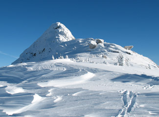
Approaching Needle Peak.
Looking back at Needle Peak.
Weather conditions can be defined in two words – blue bird. But what surprised me was absolute absence of winds – even “calm” would be too strong of a word.
Snow within the treeline was quite deep and fairly dry. Once on the ridge and getting out of the trees the top layers were wind affected but it really depended on the spot how much the wind played its role as it changed quite a bit.
Skiing experience was pretty good, especially in the tree line. On the ridge not so pleasant, due to breakable wind slab, but definitely skiable.
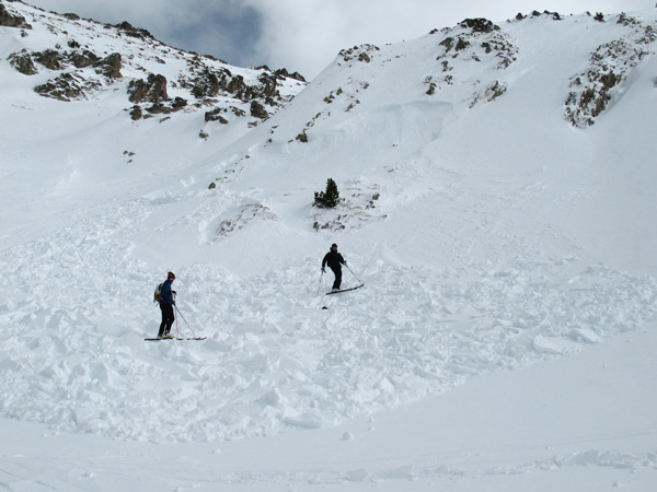
Avalanches – I observed only one debris from a small slab that was about 8m wide and run for only about 15m. Might have been about 20-30cm deep. It was on NE aspect on a wind loaded slope above tree line.

Rogers Pass (Jan 17, 2010)

No surprises. Deep track setting at Rogers Pass.
Due to high avalanche danger rating at tree line and above we opted to head for Ursus Trees and then gain a ridge on the right side of the basin and ski laps there.
Weather was typical for Selkirks – high overcast with occasional breaks chased by small flurries.
However, the temperatures felt quite warm (about -2 C) even at 2000m. The winds were calm where we were.
In the trees we skied and pretty much anywhere in the tree line the snow was…super deep and…very good. 🙂 Hard work setting a skin track though as the penetration on skis was about 30cm and more.
Skiing was Rogers Pass average, in one word – fantastic. We had the whole treed slope for ourselves, so we skied a brand new run every time.
We observed debris at couple of locations from avalanches from the previous days but nothing on that day.
Neither anything was going on a surface hoar layer in the trees we were skiing. However, these trees get skied a lot, therefore, the surface hoar might got destroyed before any snow fell on top of it.

More photos those two trips

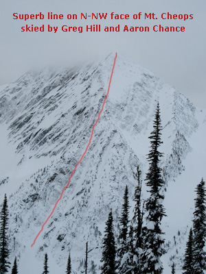
I took this photo to show you one of the coolest lines skied at Rogers Pass. Greg and Aaron did two rappels over ice falls to accomplish this first decent.
I took this photo to show you one of the coolest lines skied at Rogers Pass. Greg and Aaron did two rappels over ice falls to accomplish this first descent. I believe they did it in the 2008/2009 season.
Looking west from the top of Needle Peak.
Skiing trees in deep snow at Coquihalla.

Filed Under: Trip Reports & Conditions Tagged With: Coquihalla, Greg Hill, Rogers Pass

Cayoosh area, Duffey Lake: conditions as of Jan 10, 2010

January 13, 2010 By Stano Faban 1 Comment

Here is a quick news on how it looks for skiing at Duffey Lake area on the West Coast. During the past two weeks I did two trips to Cayoosh area:

  1. I headed there for a day on Dec 30th, 2009 and the snow coverage was quite good and the quality of snow was good too (at some places even great).
  2. Then I headed there for a second time for an overnight trip on Jan 9th, 2010 and the conditions were completely different from the previous experience and they are most likely like that even today.

In both cases the visibility was OK below 2000m, above that it was either a whiteout or not even good enough to try go higher.

Conditions as of Jan 10th, 2010 – weather, snow, skiing and avalanches

Looking back. We skinned up on a ridge that runs from east to west and can be reached from a high logging road that starts at the parking lot.
Looking back. We skinned up on a ridge that can be accessed from the end of a logging road.
Weather set it all up and somewhat spoilled a trip for me and my two friends. It was raining lightly all the way up to around 1650m, then it turned to some snow. Even over night almost no crust formed on the surface up to about 1600m. Above that very little.
Visibility was good up to 2000-2100m and there were occasional breaks in the clouds with blue sky and sun peeking through.
Snow was very wet – “late afternoon in May conditions” – up to about 1750m and it was wet down to about 30cm below the surface. The snow was quite moist all the way to 1950m.
There was a small accumulation (2-4cm) of new very moist snow on top of an older thin crust during the two days.
Skiing wasn’t what we expected but all in all…it wasn’t that bad – very warm and wet spring conditions in January.
We didn’t even get on the Armchair Glacier that leads you to Cayoosh Mounatin as the visibility was very poor. But I did not expect skiing to be much better there – drier for sure but very wind affected (as I observed on Dec 30th).
Avalanches
Couple of good turns at around 1900m. This is just before the old morain that has to be crossed to reach Armchair Gl.
Couple of good turns at around 1900m. This is just below the old moraine that has to be crossed to reach Armchair Gl.
Surprisingly, with this rapid warming trend we didn’t see any avalanche activity whether natural or caused by us or other people. For sure, there were occasional sloughs running from our skis on steep terrain but nothing scary at all.
We did a shovel compression test on N-NE slope at top of the tree line and we didn’t get any results that would make us worry.
So within the elevations we were touring in we skied pretty much anything we wanted and nothing was giving any impressions of instability.

Photos

Since pictures tell more than 1000 words here are some more:

Crossing the open gully at around 1550m.
Crossing an open gully at around 1600m.
Looking east and down to Cayoosh pass and Duffey Lk road.
Because of the wet snow at lower elevations and somewhat colder temps (-2 C) higher up, some of us had snow building up on the bottom of our skins.
Because of the wet snow at lower elevations and somewhat colder temps (-2 C) higher up, some of us had significant snow shoes building up on our skins.
Photos taken by Stano and Tomas.
If you have any questions regarding the conditions on those two occasions feel free to ask below. Or report more recent observations for others.

Filed Under: Trip Reports & Conditions

Alpaca Peak, Coquihalla: snow conditions and touring with John Baldwin

December 20, 2009 By Stano Faban 1 Comment

Yesterday, December 19th, the weather forecast predicted a break in the recent storm cycle on the South Coast and five of us headed to Coquihalla area which is best known for the Coquihalla Highway (between Hope and Merritt, in BC).
The trip was special for me because the timing of my and John’s schedules finally collided and I was able to get a touring day alongside someone that introduced me to Canadian mountains (via his guide book), and through his projects inspires me to find and define my own ski touring goals and dreams.

The day – weather, snow, skiing and avalanches

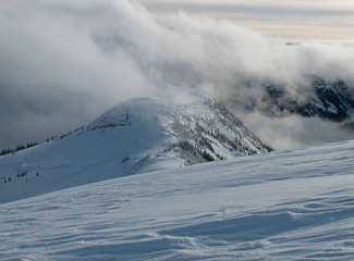
Looking south towards Zupjok Pk. The clouds kept coming and going.
We chose our objective based on the current avalanche conditions and the weather that was forecasted.
Alpaca Peak (2040m) is a full day ski touring trip that follows about 4-5 kilometers long ridge, over Zupjok Peak and Llama Peak. Access to the ridge is via a logging road and steep trees.
All that means that trip is doable in almost any avalanche conditions and the views are spectacular.
However, in the fog the navigation on the ridge can be very tricky. You can find the trip in John’s book “Exploring the Coast Mountains on Skis” on page 198 under “Alpaca Peak”.
Weather
Whole day, the weather wasn’t a blue bird as we got treated to something better – rolling clouds in multiple layers with occasional sunny breaks replacing fog clouds. This provided for excellent photo opportunities.
Temperatures were quite warm all day and most likely above zero Celsius up to about 1600-1700m.
Snow and skiing
The weather on the South Coast was pretty warm and wet for past couple of days. Therefore the snow conditions for skiing were a bit…miserable.
Alpine areas were either heavily wind affected or with a thick rain crust on the top, or both. Inside and below the tree line, the snow was heavy and mostly wet.
Depth of the snow pack was sufficient for good traveling conditions even at the lowest elevations (around 1200m) and in the forest.
Snow and avalanches
About the same length of the crown extended to the other side, behind my back.
As for avalanche conditions, this was one of the least stable and most tricky snow packs we could observe. The recent weather over past 2-3 weeks allowed sufficient time for surface hoar to grow into great dimensions and the subsequent heavy/wet snow fall created a thick slab layer on top of it.
By walking on a ridge, about 5-7m from the edge of a cornice, our party remote triggered  a cornice fall twice (just couple of meters apart) that then triggered an avalanche on the slope below it. Both were about 100m wide and run to the below basin, about 100m down. Through the fog cloud, the size of both avalanches appeared to be about 2-2.5.
During the day we didn’t witness any other avalanches going off, however, we observed slabs at many locations, on all kinds of aspects and at almost all elevations.

Interview with John Baldwin and trip photos

I and John are working on an interview for the SkinTrack website. Part of the interview will be a little contest for you where you can win the latest edition of John’s guide book. So make sure to check back soon.
Otherwise you can get your copy of “Exploring the Coast Mountains on Skis” guide book from John’s website or pick it up from outdoor stores that are listed on his website.
And here are some photos from the Alpaca Peak trip, outdoor and landscape photographers would have loved the light conditions.

frozen-trees
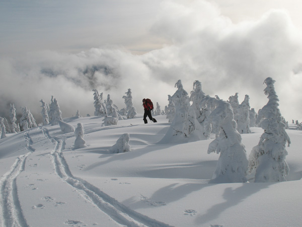
As we gained the ridge from the forest the sun lit our tracks.
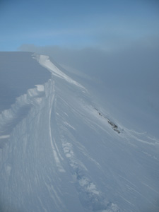
Looking north towards Llama Pk. This ridge connects all three peaks from south to north.
Setting the track up the final climb to Alpaca Pk.
In late afternoon we were treated to some amazing plays of light.

Filed Under: Trip Reports & Conditions

Rogers Pass: Canada Skimo Team's second training camp ever

November 30, 2009 By Stano Faban 1 Comment

There is a very committed group of great people that are going to represent Canada at the World Ski Mountaineering Championships in Andorra this winter. And since every team needs a little bonding experience we managed to pull off two training camps in the past two months.
treesThe first official training camp for Team Canada was in Canmore in mid-September, 2009. It was hosted by one of our Canadian skimo speedsters Steve Sellers. The aim was at getting to know each more and spending time training the engines.
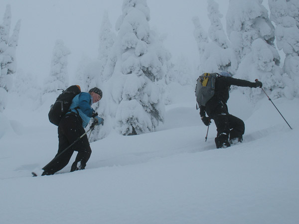
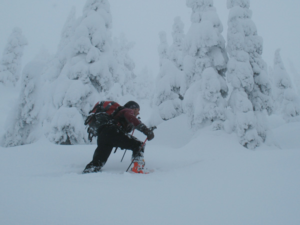
The second camp (and the first official on the snow) was hosted this past weekend (November 27-29, 2009) at the famed Rogers Pass. The emphasis was on long days with face shots. Both worked out perfectly.
Our base was Revelstoke and Golden, and the camp was initiated by Jeff Colvin and Ian Gale, two of the team members.
I didn’t take part in the first two days which are documented on Skitheory and Golden Skimo blogs but I took part in the third day and had lots of fun.
Everyone looks in good shape for the beginning of the season and most importantly everyone is very enthusiastic to represent the best place for backcountry skiing on the planet – Canada.
Here are couple of photos from the final day of the second official Canadian Ski Mountaineering Team training/fun camp. No ski photos though as there was no time to pull out the camera as everyone was charging for their line.

There is never shortage of snow at the Pass.
Our current Canadian Champ, Reiner Thoni, breaks the trail for us.
"Digging a snow pit Slovak style." Digger Stano Faban, photo Jeff Colvin.
Trans Canada Highway 1 makes Rogers Pass the best accessible place for backcoountry skiing in Canada.
The snow conditions for this time of the year are very good as the photos suggest. However, lower elevations (below 1500m) still need a bit more to be safe from alder and unexpected “under surface” obstacles.

Filed Under: Skimo Racing, Trip Reports & Conditions

West Coast snow report: 2,5m deeeep

November 20, 2009 By Stano Faban 2 Comments

Early season conditions are long time gone.
No one remembers them anymore.
White fluffy stuff keeps fallin’,
So the brave can be rollin’.
This little poem created in less than 60 seconds says it all. Simply, the current West Coast snow conditions are out of this world.

breaking-trail
Yes, there were some poor equipment choices made. But who knew Nov 14th is a mid-winter date. Thin rock skis ain't good for deep and fluffy.
Two weeks ago there was about 20cm of snow on the ground at 1600m up Whistler Mountain or at Mount Baker ski area in US. During the next 3 days over 100cm came from the sky. Since then it didn’t stop.
And it is one thing that an astounding amounts of snow fell in the south-western BC over the past two weeks, but another thing is the quality.
Even though, not as consistent in fluffiness as the slopes of Columbia or Monashee Mountains, there is real Champagne powder to be had on the Coast these days.
Over the past 12 days I toured at 3 different resorts as it is simply too dangerous to go anywhere else: Mt Baker ski area, local resort above Vancouver and on a mountain that will hopefully stay closed for couple of more days.
I haven’t heard any ski reports from other places on the Coast but based on some highway cams it looks pretty damn good for this time of the year. Here’s some more proof.
Except the “Sleeping lifts” photo other pics were taken by some of my touring partners Dusan and Tomas. Thanks a lot.
Sleeping lifts on Nov 14th.
Nov 14th.
Working slim skis felt like seventies. Nov 14th.
Back for more with fatter sticks. Nov 19th pics from here on.
2
Going down less than 30 degree slope was just...going down.
Going down less than 30 degree slopes was just...going down.
4
No lift, no problem. Just the way it suppose to be.

Filed Under: Trip Reports & Conditions

  • « Previous Page
  • Page 1
  • Page 2
  • Page 3
  • Page 4
  • Page 5
  • Next Page »

Primary Sidebar

  • Facebook
  • Instagram
  • YouTube
Our Facebook Page

skimo-manual-banner-300px
 

Recent Articles

  • Kilian Jornet Interview: About His New Foundation, His Own Environmental Impact, and How He Wants To Help Athletes and The Outdoor Industry To Protect Nature
  • How Fast Are Glaciers Really Melting? How Will This Affect Your Mountain Adventures? Interview with Pascal Egli
  • Book Review – Art of Freedom: The Life and Climbs of Voytek Kurtyka
  • Forest Skis: Innovative, Custom Build, For Backcountry Skiing and Freeride
  • Lighter and Completely Redesigned: New CAMP Ultralight Ski Mountaineering Ice Axes

Categories

  • Contests & Giveaways
  • Crazy Tracks
  • Events & Races
  • Gear, Tech & Food
  • General News & Articles
  • Industry Press Releases
  • Movies & Books
  • News Shorts
  • People (Interviews)
  • Racing 101
  • Reports & Results
  • Reviews
  • Skimo Racing
  • Training, Tricks & Tips
  • Trip Reports & Conditions

Footer

About SkinTrack

Travelling through snowy mountains on skis is like flying… and experiencing life at its core.

Gear reviews, interviews, adventures, contests, skills, skimo training, race reports – we connect you to all things related to self-propelled skiing.

SkinTrack.com, created by Stano Faban, was born out of passion for ski mountaineering and ski touring. Over the years, it has become one of the most popular ski mountaineering blogs in North America.

Recent Articles

  • Kilian Jornet Interview: About His New Foundation, His Own Environmental Impact, and How He Wants To Help Athletes and The Outdoor Industry To Protect Nature
  • How Fast Are Glaciers Really Melting? How Will This Affect Your Mountain Adventures? Interview with Pascal Egli
  • Book Review – Art of Freedom: The Life and Climbs of Voytek Kurtyka
  • Forest Skis: Innovative, Custom Build, For Backcountry Skiing and Freeride
  • Lighter and Completely Redesigned: New CAMP Ultralight Ski Mountaineering Ice Axes

Useful Links

Comparing the lightest: Skis | Boots | Bindings

Skimo Training: Training Plans | Videos

Stay in Touch

  • Facebook
  • Instagram
  • Twitter
  • YouTube

Copyright © 2025 SkinTrack.com. All rights reserved.