• Skip to primary navigation
  • Skip to content
  • Skip to primary sidebar
  • Skip to footer

SkinTrack

  • Lightest Gear
    • Skis
    • Boots
    • Bindings
    • Skins
    • Packs
  • Skimo Training
    • Training Plans + Skimo Manual
    • Transitions Videos
  • Facebook
  • Instagram

Trip Reports & Conditions

Summer Training – New Fastest Known Time on the Howe Sound Crest Trail

August 12, 2014 By Stano Faban Leave a Comment

The Howe Sound Crest Trail mostly follows the ridge crest in this photo from the ferry.
On August 4th, 2014, Gary Robbins set a new fastest known time (FKT) on the Howe Sound Crest Trail (HSCT) in Cypress Provincial Park. Twenty-eight kilometres of alpine and sub alpine terrain that goes from West Vancouver to nearly Squamish, roughly paralleling Highway 99, the HSCT is a popular multi day hike that has become increasingly popular with runners as mountain running takes hold.
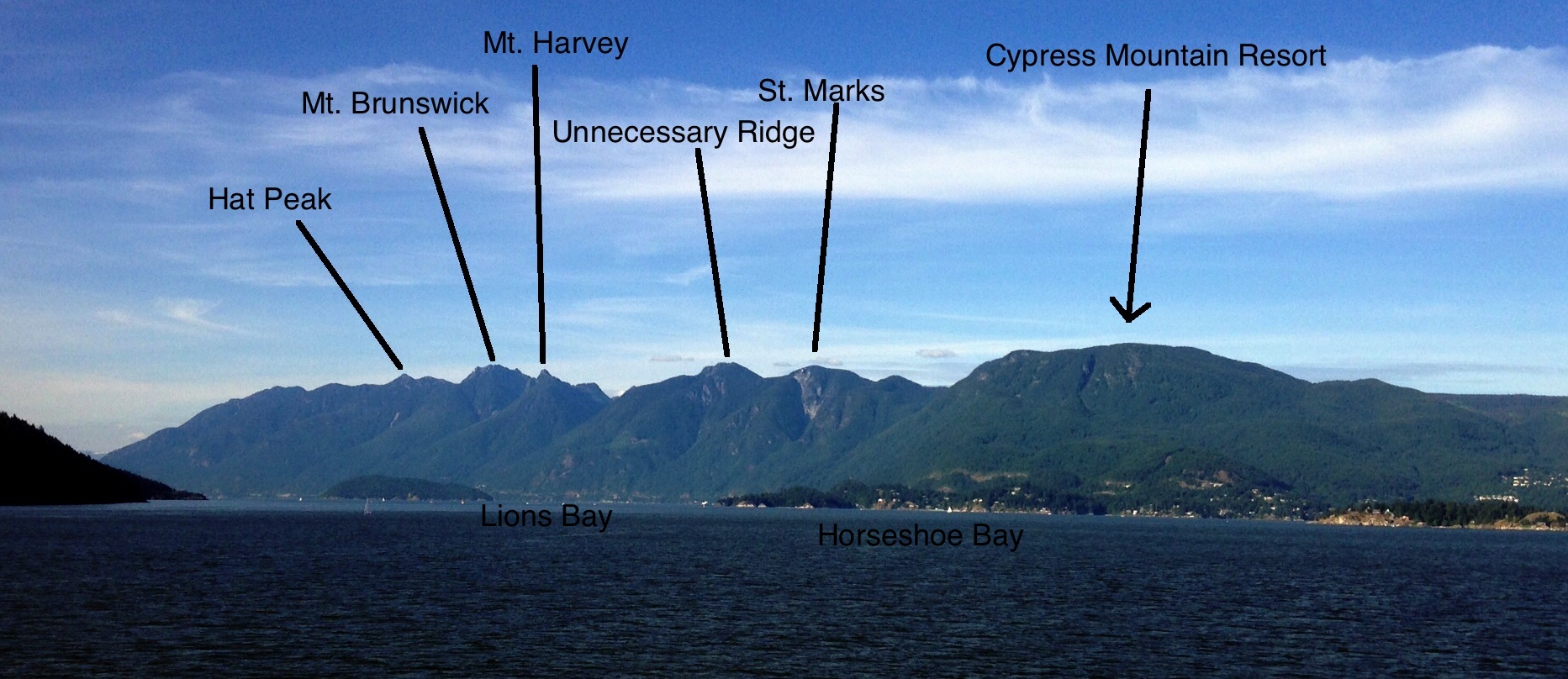
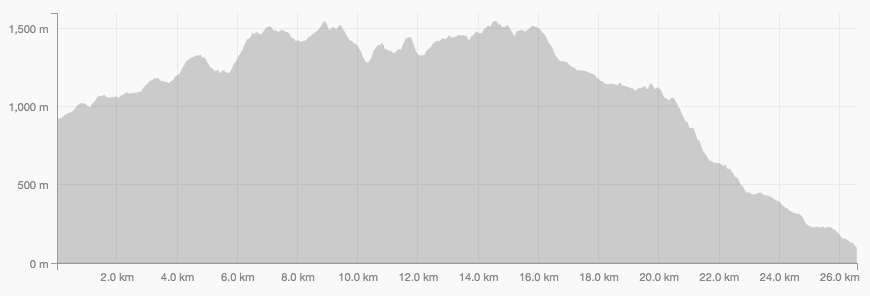
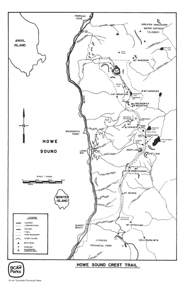
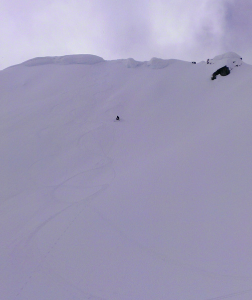
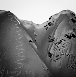
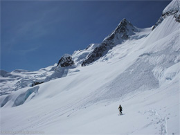
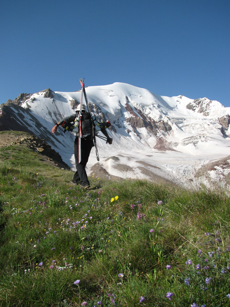
The route begins at the base lodge of Cypress Mountain Resort and takes a well maintained path around Mt. Strachan before climbing up and over St. Marks and Unnecessary summits. Past Unnecessary, the trail becomes much more rough as it passes by the well travelled West Lion trail from Lion’s Bay. Beyond the Lions, the trail is steep, rough and overgrown as you pass or climb over Thomas, David, and James peaks before climbing up to the emergency hut at Magnesia Meadows between Harvey and Brunswick Peaks. A short flat section takes you to Hat Pass and the beginning of a long descent down past Deek’s Lake into Porteau Cove on the Sea to Sky Highway.
Slide1At the end of July, Nick Elson and I had a crack at the trail, setting an FKT of 3hrs 51min on a hot day. We hoped our record would stand for a little while but six days later, Gary Robbins made his successful attempt. Gary is an accomplished ultra runner and race director of the Squamish50 Ultra Marathon coming up in a few weeks. Gary also spent his first season training for ski mountaineering this year with us, racing at the Alpental Vertfest in February.
Mountain runs like the HSCT are excellent training for skimo. Between three and four hours of running is similar to a skimo race. The trail requires a mix of running and power hiking as well as significant downhill running that will help contribute to leg strength for the winter.
Here is a quick interview with Gary about his run (and a few notes by me):
hscteleQ: What made you decide to go for the record?
​I have run the HSCT five times now but always with a group of friends. I’d always wondered how fast I could get through that terrain and had intended to do so at some point this summer. It was coincidental that it happened less than a week after Eric and Nick’s run and their time certainly kept me honest out there..
Q: How much of the route were you able to run?
​I was able to run 90% of the descents and about 60% of the climbs. There are some overgrown sections that prevent the ability to run but outside of that whatever grade was runable I managed to force myself to run.
Q: What makes the HSCT a good route to try for an FKT?
​It’s just a classic local route and stunningly beautiful. There are lots of contrived FKTs out there these days, but the HSCT is as pure as it gets, full point to point, no senseless deviations, and linking together some of the best terrain in the lower mainland.
Slide2Q: What was the hardest part of the day?
The climb up on and over Mt. Unnecessary was a definite low point where I was staring to feel the effort.​ (I found the section climbing up to the Harvey-Brunswick Col and Magnesia Meadows to be the most difficult. The trail would be runable if it weren’t so overgrown with low bushes. Even worse, the bushes are only knee to hip height so provide no respite from the sun that was beating down hard. We were also running low on water at this point.)
Q: What was the best part of the day?
​Going over St. Mark’s Summit first thing in the morning, 34 minutes into my run and knowing that I was on FKT pace and feeling like I was about to have a very special day.​ The views from up there always make not stopping and taking it all in a bit of a crime.
Q: Hint for someone looking to run the route in a day?
There is next to no water out there, be prepared and carry ample food and fluids. There are two backcountry huts on the route, both near water sources, other than that there’s nothing else to be had.​
(This is very true. We carried enough water to be self sufficient until the Magnesia Meadows Hut where we refilled. After starting the descent from Hat Pass, you cross several streams and creeks and carrying water is no longer necessary.)
hsct_map

Filed Under: Trip Reports & Conditions Tagged With: FKT, Gary Robbins, Howe Sound Crest Trail, HSCT, trail running

New Fastest Known Time for Mount Rainier: Up and down in 3h 51min 40sec

June 9, 2014 By Stano Faban 4 Comments

This is pretty much old news now but for various reasons we have not been able to cover it for you yet.
In short, couple of days ago, SkinTrack contributor Eric Carter was able to set a new fastest known time (FKT) for the ascent and descent of Mount Rainier via the usual Disappointment Cleaver route. The previous record was held by brother Andy and Jason Dorais using skis as well.
For the long story you can head over to Backcountry Magazine article – http://backcountrymagazine.com/stories/reign-rainier-carter-resets-speed-record/

Filed Under: Trip Reports & Conditions Tagged With: Eric Carter, Mount Rainier

6h 34min: New speed record on the full Wapta Traverse by 1 hour!

May 13, 2014 By Stano Faban 8 Comments

Back in 2012 my two good friends and Canadian Skimo Team members, Melanie Bernier and Ian Gale, partnered together for what at the end happened to be a new record for the full Wapta Traverse. They set it down to 7 h 35 min for this 43 km long and 2200 m of gain famous ski traverse in the Canadian Rockies.

By skiing down from Balfor Col guys were realizing a great time is in sight.
Last Sunday, May 11th, a duo of another two skimo friends (that were still “novices” back in 2012) consisting of Peter Knight and Travis Brown took advantage of some fine weather and hit the traverse in what looks like stellar speed conditions. At the end, Peter and Travis shaved 1h of the old record and set the bar to 6 h 34 min!

When we got onto the glacier, there was 1-2cms of new snow on top of a very supportive crust and it was actually faster to ditch the old drifted in skintrack and make our own. – from Travis’ blog post

I like to think that the recent interview for Skintrack gave them the final boost of motivation that pushed them towards such a great performance – they had to match the hype with performance 🙂
And here is what Peter had to say about their effort in his usual style:

We weren’t feeling too bad afterwards and we contemplated doing a Bow Summit victory lap when picking up Travis’ car.

Wapta Traverse details

Here’s a screen picture after Travis uploaded their day from his Suunto Ambit 2 (watch review here).
wapta-speed-record
And here is a publicly available Wapta ski traverse map on Google maps:

For more info and photos from their day see their Suunto’s Movescount file and Travis’ blog post.

Wapta under 6h?

For over a year now, I have been long convinced the Wapta traverse can go under 6h, perhaps even close to 5h. However, everything would have to line up perfectly – conditions, people in shape in the right time, and sufficient snow pack that season.
What do you think? Can be Wapta done in 5h?

Filed Under: Trip Reports & Conditions Tagged With: Peter Knight, Travis Brown, Wapta Traverse

Another Duffey Lake adventure: Duke Couloir, big cornice rappel, north face of Vantage Peak

April 27, 2014 By Stano Faban Leave a Comment

As of two weeks ago, conditions around Duffey Lake seemed to make the final turn towards spring until the weather started acting up and proceeded to blanket the area with fresh snow every so often. With faster missions on hold, it was time to explore.

Eric’s plan, my alterations

Forecast for Saturday (yesterday) looked good enough so Eric revealed his idea of skiing a very protected, north facing couloir off Mount Duke based on reference from couple of people.
With the goal agreed on I decided to alter the approach and the ski-out routes as I was unwilling to walk so far on flat for what looked like a 150 m chute on Google Earth. I proposed a more adventurous approach via Cerise Creek drainage on the way in and skiing the N face of Vantage Peak on the way out.

The route. We connected the 2 cols with a traverse on the south side of Vantage.
The route. We connected the 2 cols with a traverse on the south side of Vantage. About 23km and 2300m in total.

Duke Couloir

With the day plan set Eric, Pascal and I headed up Cerise Cr and towards Vantage Col under grey skies. Thanks to clouds and being there early we were able to traverse the big south facing slopes of Vantage Peak safely and we managed to ski right into the col west of Duke.
After about 3h of walking and skiing we were atop our first objective. And as expected, the couloir entrance was protected by a massive cornice. Pascal and Eric quickly went to work – Pascal trying to get the cornice smaller with Eric belaying him. I was a communicating channel between the two as the strong wind made it impossible to hear each other even from 10 m apart.
Once we concluded the cornice was way too big/deep to chop anything sizeable off, but also too big to fail, we dug a big hole to bury our hi-tech anchor – a foot long two-by-four 🙂
Then it was time to ski. To “increase” our safety margins, we rappelled in and skied the couloir until the fan one by one. The couloir turned out to be not very steep or super narrow as expected but the setting was absolutely amazing – half-pipe skiing confined by 30 m walls on both sides, with a big white beast guarding it all. Superb!

Vantage Peak – North East face

Originally, I thought we would have time to also go back and ski the N face of Duke but after the rope got stuck in the cornice so deep we got to go back but to retrieve it rather than ski. Once there, we dug out the anchor slings and the two-by-four as well, then skied the ridge back to the col.

On the summit of Vantage.
With winds bringing more clouds again we raced to the summit of Vantage to drop in before the flat light would ruin the whole thing. After hacking off some cornice we enjoyed great powdery turns before less enjoyable spring conditions set in lower in the bowl.
Dropping in for a hard ski cut.
Eric enjoying some fine powder!
I managed my biggest bail of the season on this last run to give us all a big laugh to cap off the great day in the mountains. I tried to blame it all on flat light, crust and skis but the boys saw right through me 😉

Filed Under: Trip Reports & Conditions Tagged With: Duke Couloir, Vantage Peak

Back on skis: Skiing new, Bailing on old, Winter camping…

February 5, 2014 By Stano Faban 3 Comments

After being out of the ski game for much of November and December due to injury I eased into January with caution. I have to credit my good friend and SkinTrack partner, Eric, for dragging me out when the conditions weren’t inspiring and I was still stressed out about hurting my ankle again.
With ankle getting better with each small outing I decided to go out on some true adventures as the only way for me to get motivated again.
And so in the past two weeks I spent seven days on skis of which only one was on race sticks on a ski hill and the rest in the backcountry.
This is how I survived it all – few cans gone missing.
ski-bum-home

Bailing on a traverse

With unusual conditions (little snow, lots of sunshine) this year on the Coast, Brad and I decided to give a shot to 2 day traverse I did couple of years ago (North Joffre Creek traverse at Duffey Lake area). We knew chances were 50/50 but why not try and see. On the 2nd day we decided to bail as couple of slopes were asking for trouble.

Exploring some new lines

After the unsuccessful traverse but very entertaining 2 days Brad and I teamed up again for a 2 day mission on Duffey again, but this time into Steep Creek area.

Fog and glaciers don’t mix up well

The night Brad and I came out of Steep Cr we enlisted for a big mission the next day. The objective was to summit and ski the North face of Garibaldi which means a heck of a long approach for a day mission with unknown obstacles awaiting.
Eric was the initiator and five of us (Eric, Brad, Gary, Carl, Stano) set out from the car in almost race-like pace in the morning. We had to bail about 200 m below the summit as we would be pushing our chances with daylight, not leaving any margin of safety in case something went wrong. We should have perhaps started an hour earlier but an hour lost walking roped up around “never-seen-before” crevasses in the fog was the bigger factor in my mind. We will be back for sure.
Photos by Gary Robbins.

Million dollars on Cayoosh

After 2 days at Steep Cr followed by the Garibaldi mission I was pretty trashed but why not go ski something when it’s Sunday and stability and weather are great. And so with a good old friend, Rado, we headed back to Duffey eyeing to summit Cayoosh and earn some cash in the Million Dollar Couloir.

Filed Under: Trip Reports & Conditions Tagged With: Cayoosh Mountain, Duffey Lake, Million Dollar Couloir, Mount Garibaldi, North Joffre Creek, Steep Creek, Steep Peak

Best 6 Ski Mountaineering Reported Trips of 2012-2013 "season"

December 11, 2013 By Stano Faban Leave a Comment

The other day, on Twitter, Carl (@CarlKohnstamm) asked me for my opinion on “What are the top 5 ski mountaineering trip (reports) of 2012-13”? (It was worded a bit differently but after clarification that is what he meant.)
That is a one damn great question – fun to answer but by no means it’s easy. Here I am going to attempt to best express my opinion while approaching the question from a wider perspective, and obviously taking into account only trips that I know of.
Note: FKT stands for “fastest known time”

1. Matterhorn FKT (2h 52min) – by Kilian Jornet

Kilian somewhere high on Matterhorn. (Uknown photo credit.)
I know this was done running and not on skis but to me this is The Mountain Performance of 2013!
Why I included it? Because it was realized by arguably the best skimo racer ever. Kilian “ran” from Cervinia, Italy (around 2,050 m) to the top of Matterhorn (4,478 m) in 1h 56min, which was an ascent speed of 1,256 m per hour!
He descented back in 56min which was a descent speed of 2601 m/h – that is almost like skiing!
» One of the various reports from this “trip” can be found on Climbing.com – http://www.climbing.com/news/kilian-jornet-shatters-matterhorn-speed-record/

2. Mount Rainier FKT – by Jason and Andy Dorais

Uber happy Andy and Jason Dorais after setting the FKT on Rainier. (Photo from Jason's blog.)
Uber happy Andy and Jason Dorais after setting the FKT on Rainier. (Photo from Jason’s blog.)
In my opinion, their time of 3h 57min raised the standard of North American speed ski mountaineering to the next level. It’s not out of this world but they were the first to push it under 4h.
Besides, Mt Rainer is almost 4,400 m high (14,411 feet) and the route up it definitely includes enough hazard negotiation that one cannot just go without thinking. Skiing it down fast is also quite dangerous.
This is also the one performance of 2013 that pisses me off the most as Dorais brothers stole the record from our team only about 10 days after Eric Carter and Nick Elson pushed their old one down to 4h 19min. 🙂
» Report by Jason from their attempt – http://jasondorais.blogspot.ca/2013/06/mt-rainier-speed-run-35755.html
» Report from our trip – http://www.skintrack.com/trip-reports-conditions/mount-rainier-record-4h-19min-12sec/

3. Steep descents in Coast Mountains – by Tevor Hunt

To see tracks on the full face visit Trevor's blog. (Photo from Trevor's blog.)
To see tracks on the full face visit Trevor’s blog.
While searching for things to put on this list Eric pointed me back to something I read months earlier.
This is a superb read of a solo descent of a steep face on an undisclosed peak not too far from civilization in the Coast Mountains of BC.
But this one is only one of many under-the-radar (1st) descents of the little known steeps hunter Trevor Hunt.
(Interview with Trevor coming soon!)
» Read “Full Commitment” here http://www.coaststeepskier.com/wphome/?p=21242 

4. Tantalus Traverse in a day (FKT) – by Skyler Des Roches, Christian Veenstra

Crossing the Rumbling Glacier – Christian Veenstra photo.
Speed is cool but if adventurous aspect of the objective comes first then it’s even cooler. The Tantalus Range can be easily seen from a comfort of your car but to get there and out isn’t a piece of cake, and never mind navigating some big broken up glaciers.
A fitting quote from their day:
“Crossing above above a nunatak, then literally sprinting below a fierce cracked serac cave, we made our way along another bench between crevasses until we reached a notch on the south shoulder of Dione.”
» Here’s the full account of this 17h day – http://runoutoffroute.wordpress.com/2013/05/22/tantalus-traverse-in-a-day/

5. Spearhead Traverse  2 x FKT – by Eric Carter, Nick Elson, Brad Schalles

Spearhead Traverse has been testing grounds for Coastal speedy ski mountaineers for a long time. The tradition was likely started by no other than Greg Hill back in 2004 or so on the classic version (Blackcomb to Whistler Village via Singing Pass).

Eric and Nick handsomely posing after their Spearhead FKT. (Photo from Eric's blog.)
Eric and Nick handsomely posing after their Spearhead FKT. (Photo from Eric’s blog.)
Then in 2006 and 2009 I personally took stabs at both versions with really valuing my 2009 effort on the full traverse (Village – Blackcomb – Singing Pass – Whistler Peak – Village) of 8h 11min over 4230m and about 50km.
This spring three of my good friends took on these records with great success:
First, Eric and Nick lowered Greg Hill’s classic version of the traverse record from 4h to 3h 10min
http://coastmountainskiing.com/race-spearhead-traverse-fkt/
Then couple of weeks later, Brad Schalles called me to investigate the route I took in 2009 on the long version to make sure he stayed on it as close as possible. He pushed the time down to 6h 47min! No report but Brad’s blog is here – http://westcoastskimo.blogspot.ca/

6. Steep skiing on Mount Robson – by Reiner Thoni and Jeff Colvin

reiner-skiing-robsonReiner and Jeff are my good friends from which I have learnt a great deal whether about mountains or just life in general. I was happy to see that after over a year of not seeing each other they were able to hook up for such an adventure this summer.
By now, Reiner knows Robson very intimately – summitted it about 5 times and skied it twice in last 2 years – yet this must have been a highly rated trip up a familiar mountain.
For those that don’t know Reiner – he is consistently highest placed North American at skimo world champs and placed 15th at Pierra Menta last March. But his big heart mostly beats for things outside of racing.

Eye candy

I left videos out of the above list on purpose. Because if you are like me then I didn’t want you to get caught up in a spectacle and forget about priorities. And you are welcome 🙂
Here’s a short clip of Kilian’s record on Matterhorn.

Reiner’s and Jeff’s skimo adventure on Robson.

Honorable mention
This didn’t make it to the list as it has nothing to do with ski mountaineering but what a performance and inspiration – Ueli Steck speed soloing South Face on Annapurna this October. More at Alpinist – http://www.alpinist.com/doc/web13f/newswire-ueli-steck-south-face-annapurna

Filed Under: Trip Reports & Conditions Tagged With: Andy Dorais, Brad Schalles, Christian Veenstra, Eric Carter, Jason Dorais, Jeff Colvin, Kilian Jornet, Matterhorn, Mount Rainier, Mount Robson, Nick Elson, Reiner Thoni, Skyler Des Roches, Spearhead Traverse, Tantalus, Trevor Hunt

First Tracks – Oct 2nd!

October 5, 2013 By Stano Faban Leave a Comment

The Coast has been getting pounded with rain in the valley and snow in the alpine so I snuck out for a morning of skiing near Cypress Peak. We have good snow above 1500m and it is dumping down more! This is definitely my earliest first ski of the year.
Whats the earliest you have skied new snow and where is your local go-to early season ski stash?

Filed Under: Trip Reports & Conditions Tagged With: Cypress Peak, Early Turns, October, Skiing

China-Kyrgyz expedition, part 2: Beautiful Kyrgyzstan + Winds on Lenin Peak + Bishkek uncensored

August 21, 2013 By Stano Faban 2 Comments

Here is part two from our ski expedition to Muztagh Ata and Lenin Peak we went on last month. To read part one see here – Skiing thin air at Muztagh Ata + Kashgar culture adventures.
More info: Being an information junkie, throughout these posts you will see lots of links to Wikipedia articles. I wanted to make it easy for you to find more info about places we visited and things we saw, in case you want to go.

From Kashgar to Lenin Peak base camp

Pamir Expeditions arranged transport for Peter and I from Kashgar to the Achik Tash base camp under Lenin Peak. As we needed to cross the Chinese-Kyrgyzstan border again we knew this was going to be a long day. And 200km on dirt roads segmented between 400km on paved ones was going to make it one hell of a sitting marathon.
Chinese borders
Through the two different borders we went to and from China (Torugart Pass in and Irkeshtam Pass out) we observed a novelty – the Chinese border is simply closed over the weekends! You get there Friday night and you will need to wait until Monday morning.
I don’t know whether this is the case with borders with other countries as well (Tajikistan, Pakistan, Pakistan…) but it was at these two crossings.

The official geographical Chinese-Kyrgyzstan border. Check-point was 10km prior to this funny looking crossing. Once again, we had to switch cars.
Chinese building the roads
On both sides (for about 150km) of both crossings we witnessed what this powerful country can do. It is in Chinese business interests to renew the old Silk Road and so they are paying for building new roads through borders with Kyrgyzstan, even outside of their country. The condition is – their workers will get the work.
Drivers
As soon as Europe, Peter and I realized that professional drivers (taxi, bus…) are quite the characters. And our arranged pick up connection on Kyrgyzstan’s side was no worse.
Genadiy, a Russian long living in Kyrgyzstan, was 74 and thoroughly enjoyed taking his 1992 Isuzu Trooper close to speeds almost twice his age. To keep the car on the road he needed its whole width, so half the time we were in the opposite lane. But he was one funny friendly fella thus all was quickly forgiven. 😉

Women and Lenin Peak base camps

Now I got you thinking with that heading, eh?
There are essentially two base camps at Lenin Peak (they call the higher one Camp 1). First one – Achik Tash base camp – is where you get off the car, at 3700m, and the second one is a 5h hike away at 4450m, on a foot of a glacier.
Each agency (about six of them) have one camp at both places, however, at both Pamir Expeditions has the best location in terms of saving you some walking.

The four of us - Lenin, Peter, Lenin Pk, and I.
The four of us – Lenin, Peter, Lenin Peak, and I.
Ladies are running the show
At both locations, the bosses at Pamir’s camps are women – Mariya and Nikka – both strict yet very, very friendly.
At Camp 1 (the higher BC), where we spent couple of days, Mariya must have amazed every client with how she managed unique demands of about 40 people while non-stop smiling each and every day. We felt that she alone created half of our great experience at Lenin Peak. Thank You!
Food
Food at both base camps was truly amazing. Lunches and dinners usually started with two different kinds of salads followed by a bowl of rice or noodles with meat. Later, either fresh fruit or some cake followed. And with everyone losing appetite I was in heaven. I don’t hesitate to finish other’s meals when hungry. 😉
Our base camp (3700m) at Lenin. The Peak is the highest point in the middle.
Our base camp (3700m) at Lenin. The Peak is the highest, rocky point in the middle of the photo.

Dethroning Lenin

The Lenin Peak (7134m) is named after arguably the biggest communist the world has ever seen – Vladimir Ilyich Lenin. I really hoped that after summiting Muztagh Ata I could take on this revolutionary leftist with ease.

Amazing view inside my Camp 3 (6200m) tent.
Since Peter and I felt pretty good after two days of low altitude travelling and city strolling we decided to go straight to the summit without further acclimatization. Unfortunately, at Camp 2 (5300m), Peter started to feel not so great and was losing appetite quickly. So the next morning I was on my own again.
With about a heavy back-pack three days in a row I climbed to Camp 3 at 6200m which is located at an amazing spot, on top of Razdelnaya Peak. The name essentially means a “divider” as this is the point where three ridges meet.
As soon as I put up my tent a head popped out of a neighbouring one and a Tajikistan guide invited me in for some tea. We talked for couple of hours and I still remember his answer to my question whether he ever goes to Himalayas. He said: “Did you see over the ridge to the other side? That is Tajikistan. Why would I need to go to Himalayas?” And he was right, on the other side of the ridge was a sea of snowy mountains, just like in Canada. 🙂
Summit day
Once again, I slept pretty well at this altitude, however, not for very long. Most of the people trying for the summit that day were leaving around 3.00am and were walking with crampons on right by my tent. I couldn’t figure out how they are doing it since still at 10pm I heard half the them coughing and choking due to not being used to such altitude yet.
I left just after 5am with the plan to skin the 1000m to the summit. Then ski back to Camp 3, rest some, pack up and ski down to Camp 2 to Peter.
All was going pretty well until I reached a big platoe at around 6400m. This is where one pops out from a somewhat sheltered slope onto an exposed ridge. It was probably around 7.30am and I spent the next two or three hours battling the wind, hiding behind the rocks, battling the wind, hiding…
The red lines show how we got from BC to Camp 2 (hidden behind a ridge). From Camp 3 I followed the obvious ridge, and the X shows where I turned around. BTW, the ridge and the summit are in Tajikistan.
At about 6600m I calculated that it would still take me about 4h to the summit along this long ridge. By then, I was long without skis as I realized earlier that it would be impossible to ski down this route with so many rocks being exposed. It wasn’t impossible in terms of skill but rather impractical as I would still have to walk some parts on foot, thus, would have to transition from skis to crampons and back for couple of times.
Also, by then, I was getting tired. My breathing was well (thanks to Muztagh Ata) but I was already five or so hours walking and could feel the previous three days of big back-pack on my shoulders. The wind made things worse… or easier as it made the decision of turning around less painful.
And so I went down walking some, skiing some, going slow and really enjoying the views around me.
By Camp 3 I have decided to pack up and not try again. By then I was honestly tired of the whole expedition thing and could not see how I would motivate myself to go back up the same trail. So I skied back to Camp 2 and the next morning Peter and I had some superb turns over crevasses down to Camp 1 (the higher BC).

Skiing lower peaks

Peter welcomed my decision to not try again as we could finally hook up to ski together.
The day after skiing down to Camp 1 we tried to climb about 5300m peak which we later named Mariya in honour of our fabulous host. We didn’t summit as we got to its final 300m steep wall about an hour too late. Everything was rapidly melting and sloughing, instead, we tried to make it to the lunch table on time.

Heading up Petrovsky Peak (4750m).
The next day we walked down to the official base camp enjoying stunning views all day long. Both of us commented on how much more we liked the environment here than at Muztagh Ata.
Both places are beautiful but here in the Pamir Mountains the surroundings have tremendous variety – colours, shapes, some kind of freshness. Muztagh Ata is beautiful as well… when you are 10km from it. Because once you are on it everything you see in the distance is dry and is pretty much a desert.
Give me blue, white, red and green, and I will rob a bank machine :)
Give me blue, white, red and green, and I will rob a bank machine 🙂
Schooling at Peak Petrovsky
Once back at Achik Tash base camp we had two more days to kill. The next morning we went up a ridge that leads to Peak Petrovsky at about 4750m. This beautiful, long, progressively gaining ridge is popular for acclimatization.
We were strolling out the BC before 6am and made the fake top by 10.15. It looked like the true summit was maybe 10 metres higher but about 20min away on an up-and-down non-technical ridge. From there we would have to return the same way before we could ski down, so we opted to ski before the heat melted the snow too much.
After two hours of scary I finally climbed out of there.
Our plan was to ski down the broad ridge we ascended for about 150m, then directly down a steep face. Once on top of it I went side slipping into the face and instantly we could see it was very hard. I traversed out and we decided to wait half an hour.
During our wait we observed that we needed to cross the hard slope to what looked like a snow band running all the way down the icy 400m face, all 45 degree skiing.
Once we carefully traversed/side-slipped (with an ice axe in one hand) onto the promised snow I realized it was 10cm of totally wet on top of ice. The snow was just sliding away from my bottom ski.
After some trying to get lower in hopes of it getting better it truly did… for about 5m, then back to wet slush. By this point Peter back-tracked out but I was too far in it to easily decide. At the end, I spent about 2h of trying to side-step lower to where I hoped better snow would be. All this time chopping away little holds for my upper hand to hold on to the face.
Then a blessing idea crossed my mind that perhaps I should do what Peter yelled at me an hour earlier: “Put crampons on and climb out of there!” And so in sequence of super slow-motion movements I managed to put on both crampons and get out of there, all along thinking how the hell did I get so much into it.
Once back on the ridge and happily lying in the snow I realized that this was the most dangerous thing in the whole month of traveling… apart from some crazy driving.
Lessons learned (or repeated)

  • If you suspect the snow will be hard, climb the slope before you ski it. 😉
  • When steep skiing always wear a harness, so you can anchor yourself if you need to put crampons on. 😉
  • To carry a rope is never a bad idea. 🙂
Are we in Canada, New Zealand, or Switzerland? It's Kyrgyzstan, dude.
Are we in Canada, New Zealand, or Switzerland? It’s Kyrgyzstan, dude.

Bishkek – the capital

As with Kashgar, I want to introduce you to a city that is very important to the region. Bishkek is the capital of Kyrgyzstan and is pretty much The gate into the country for westerners.
Since Kyrgyzstan used to belong to the former Soviet Union signs of communism are everywhere. It is a Muslim country, thus, the two architectures clash sometimes.

Soviet Union era apartment buildings in Bishkek.
Osh Bazaar
As in Kashgar, we visited a big goods market. Products sold were pretty much the same but the market was smaller than on the other side of the border. However, there were many stands selling traditional Kyrgyz hats over which I marveled for hours and bought a couple at the end.
Food and drinks
15-langman-osh-bazaar-2The Kyrgyz cuisine is the pretty much the same as throughout the whole Central Asia region, with lamb being included in many dishes. On top of langman and shashlik (tasting very similar to Uyghur style) people here also like manty – steamed dumplings filled with ground meat and onions.
We once again enjoyed an amazing langman (noodles with meat) when we were escorted by a local boy to a hidden eatery inside the Osh Bazaar. When we entered the room the 50 or so Kyrgyz looked very surprised how two white westerners managed to sneak this hidden gem out.
On another occasion I opted for lamb ribs while Peter went for some more Russian style dish. I am not a big ribs eater but these were hands down the best ribs I ever ate. The fat melting on them tasted very different to any other fat I tried before. We both suspected this was due to the fact that these ribs were likely from a free ranging animal as opposed to western-world confined live stock.
Then there is Kumis, the most famous national beverage, made from mare’s milk. It’s fermented and has some alcohol content. Unfortunately, we forgot to try it. First, the two times we were offered kumis we were just about to go up the mountains and we didn’t want to risk it. Also, neither of us is a milk lover. Then at the end we forgot to try some in Bishkek.
On the other hand, the last two days, we tried plenty of Kyrgyz beer Arpa. 🙂 But beer and alcohol in general is not very common in Kyrgyzstan as majority of its population are Muslims. Still you can find lots of big drinkers in Bishkek which is a lasting mark the Soviet Russians left here.
USSR hostel
The most bizarre accommodation experience came at the very end. The last two nights we stayed in a flat in an old apartment building. It was furnished in style of flats built in USSR during the communist times.
Trying to avoid high prices we found this absolute gem on the internet. Nothing fancy, very lovely host, USSR style, interesting people showing up and leaving… simply a great experience.
The hilarious USSR Hostel in Bishkek.
If you happen to look for it as a stand-alone hostel then do not. It’s on a fourth floor of an apartment building in the north-east corner of Gogol Street and Chuy Avenue. And it’s a walking distance from the main Ala-Too Square and many historic buildings.

Going (back) to Kyrgyzstan and Xinjiang

I really hope you enjoyed my ramblings about this trip and that they will kick you in the ass to get you out of the western world. Ski mountaineering is about exploration after all, and exploration is not only about mountains 😉
If you want to go ski (or bike, hike) to Kyrgyzstan or Xinjiang feel free to ask for more info. I would gladly share my contacts with you, so you can get a jump start on your planning/searching.
Personally, I fell in love with Kyrgyzstan and a return in couple of years might be in order.
» To read part 1 of my report see this page – Skiing thin air at Muztagh Ata + Kashgar culture adventures

Gallery

Filed Under: Trip Reports & Conditions Tagged With: Achik Tash, Bishkek, China, Irkeshtam Pass, Kashgar, Kyrgyzstan, Lenin Peak, Muztagh Ata, Osh Bazaar, Pamir Expeditions, Petrovsky Peak, USSR Hostel, Xinjiang

China-Kyrgyz expedition, part 1: Skiing thin air at Muztagh Ata + Kashgar culture adventures

August 16, 2013 By Stano Faban 10 Comments

After almost 6 weeks of travelling, skiing and exploring in Central Asia I am back in Europe before flying back to Canada. What an amazing trip!
As I wrote before, we picked this part of the world mostly to climb and ski two 7000m peaks, Muztagh Ata and Lenin Peak, but we knew that at least half the experience would come outside of our mountaineering adventures.

Muztagh Ata at sunset.
As there is so much to tell and show I have decided to split my writings about this trip into two posts. (I will talk about Lenin Peak and Bishkek in the second one.) Also, make sure to checkout the big photo gallery at the bottom of this post.
We arranged the whole trip with Pamir Expeditions but some parts were taken care of by Asia Mountains. Both agencies are very professional and I highly recommend them.
» To read part 2 of my report see this page – Beautiful Kyrgyzstan + Winds on Lenin Peak + Bishkek uncensored

Learn more: Being an information junkie, throughout these posts you will see lots of links to Wikipedia articles to make it easy for you to learn about the places we visited and things we saw and tried.

From Bishkek to Muztagh Ata base camp

Our trip officially began on July 1st in Bishkek, the capital of Kyrgyzstan, where we got picked up, along with another 4 climbers, by our tour guide and a driver.
Ramil (the guide) and Misha (the driver) were going to accompany us only for next two days, until we were going to be handed into “Chinese hands”. To us Westerners this is a strange process but Chinese simply don’t like cars with foreign plates in their country, except semi-trucks with cargo.
We left from Asia Mountains Hostel at around noon and after a full day aboard of a comfy Mercedes Sprinter we arrived in Naryn – a small town about 400km south of Bishkek.
The next day we headed 200km towards Torugart Pass where at 3700m is the official Chinese border.

Taken photos at the Chinese borders is prohibited but I managed to snap one. A big gate to a big country.
Taking photos at Chinese borders is prohibited but I managed to snap one. A big gate to a big country.
After waiting two hours our “Chinese” guide (Mohammad) finally appeared and we got over the line with the entire luggage in our hands. Strangely enough, all the people (except the customs and police officers) from there on didn’t look Chinese at all. Soon we learnt they are Uyghur and their appearance and language is very similar to Turkish. Welcome to Xinjiang!

Check-points

This perhaps 3 year-old boy is already learning from his father, a blacksmith.
This 2 year-old boy is already learning from his father, a blacksmith.
Over the next 200km we were stopped and our luggage was scanned at three check-points. The Chinese officers were somewhat friendly but they don’t mess around, bureaucracy is a must. 😉
By 8pm we were in Kashgar, a city which lies on the ancient Northern Silk Road and one I have been hearing about from my father since I was a teenager. He and a friend always wanted to bike from there to Pakistan along the famed Karakoram Highway – the highest paved road in the world.
The next day included more check-points despite travelling inside the same country. We bused from Kashgar, along the Karakoram Highway, to a small village of Subashi at 3700m. The next morning we hiked to the base camp (BC) at 4450m, camels caring most of our load.

15 days on Muztagh Ata

For me, the 5h hike from Subashi to BC was a first big test as every so often I got struck with a sudden burst of diarrhea. Each time I had to go (the 10m I could go) Peter would put on a big smile and say: “Just hold on son, the God is testing you!” 🙂 Fortunately, I got rid of it in the next 2 days.
camels-subashi
On the other hand, Peter had a very rough first night at BC and had to go down to Subashi the very next day. From there on we were on a different acclimatization schedule so I paired up with Christopher from Germany for next couple of days.
The most surprising thing of our trip was how tedious the expedition style mountaineering can be. You go up and down the same trail pretty much every day, so by the time you hope to go for the summit most of the motivation can be gone. But there is no way around it as bit-by-bit you have to expose your body to higher altitude to make it adapt.

Half way enroute from Camp 1 to Camp 2. At 5800m breathing started to be real pain in the ass.
Half way en-route from Camp 1 to Camp 2. At 5800m breathing started to be real pain in the ass.
Unfortunately, Peter never recovered from his altitude sickness and mostly spent his days skiing around Camp 1 (5400m) since he was bored at BC.
My body managed to acclimatize every time we progressed higher and I only had trouble sleeping the very first night at Camp 2 (6200m). The next day I went to 6500m and opted to ski back to Camp 1 for a day of rest. Then I went again to sleep at Camp 2 and on July 18th I reached the summit (7546m) in about 7,5h. It was the longest 1400m I have ever climbed and couple of times I thought I would turn around. But each time when such thoughts arrived I thought to myself “Hold on son, it’s only God testing you!” 🙂
The skiing back was really fantastic as 2cms overnight made things much more buttery than I experienced few days before. The first 200m off the top were very wind affected but after that Coast Mountains spring conditions awaited.
Goofing around the day before my summit attempt. There is so much time to kill on high-alti expedition.
I went to the summit solo, actually, I was on the mountain pretty much alone as there was no one above Camp 2 that day. Only two fellow Russian climbers descended to BC from Camp 3 (6800m) that day.
Christopher summited during my rest day at Camp 1. I chose not go with him since I didn’t like the idea of sleeping at Camp 3 right after sleeping at Camp 2 for the very first time.
We both gambled but at the end it worked for both us. He summited Aconcagua (6960m) two years before and so knew more about how his body might react. I played the “skimo racer” card – sleep comfortably, then try to summit in one “fast” round trip to avoid staying so high for so long.
This is what the dog saw on the summit. Clouds obscured the rest of the view.
This is what the dog saw on the summit – nothing much. Clouds obscured the rest of the view.
One of major problems I observed people faced even at the BC was loss of appetite. This, I believe, creates a downward spiral as without good nutrition your body has hard time adapting which leads to even less appetite… I was very fortunate to not have this problem but I guess this is no surprise to my family and friends. 🙂

Day by day

In case you want to try Muztagh Ata someday here is how it all went for me in terms of acclimatization and the final push.
The 17 days that is scheduled with majority of agencies is really on the edge. If you lose only two days due to sickness or bad weather you will likely run out of time. That’s also why I decided to skip sleeping at Camp 3.

Our tent at Camp 1. The sunsets were amazing.
  • Day 1: hiked from Subashi (3700m) to BC (4450m)
  • Day 2: hiked from BC to 5100m to stash ski gear
  • Day 3: hiked/skinned to Camp 1 (5400m) to put in our tent
  • Day 4: to Camp 1 and slept there
  • Day 5: skinned up to 5800m, returned to BC
  • Day 6: rest at BC
  • Day 7: due to weather rest at BC
  • Day 8: to Camp 1 and slept there
  • Day 9: skinned to Camp 2 (6200m) and slept there
  • Day 10: skinned to 6600m and back to Camp 1, slept there
  • Day 11: rest day at Camp 1
  • Day 12: skinned up to Camp 2 and slept there
  • Day 13: skinned from Camp 2 to the summit (7546m) and skied back, slept there
  • Day 14: descended to BC
  • Day 15: hiked from BC to Subashi, bused to Kashgar
Peter, Mohammad (the boss), Akbar (the cook), and I just before leaving BC. They are two amazing guys that took great care of us.

Kashgar – famed city on the Silk Road

After Muztagh Ata we were going to have one full day in Kashgar before travelling back to Kyrgyzstan, to Lenin Peak. And it was a Sunday which is when the biggest markets are on.

Food market

Everything is made right at the spot and it's all delicious. No stomach problems at all, except from being too full.
Everything is made right at the spot and it’s all delicious. No stomach problems at all, except from being too full.
The night when we arrived from Subashi to Kashgar we headed out for what became my favourite dining experience in my life. We went to Kashgar’s night food market.
The market is full of stands where food is prepared right in front of your eyes from all kinds of known and unknown ingredients. Everything tasted great.
The best part was that Peter and I were the only foreigners at the market. (Our climbing friends opted for “safety” of a restaurant.) The local people looked surprised to see us there but everyone was friendly.
We were also lucky to find the market super absolutely full. Because Uyghur people are Muslims they were just observing Ramadan. This means they cannot eat or drink during the daylight at all but once the sun sets they all meet at such food markets and enjoy freshly prepared meals.
The horse is getting new shoes. But at first I thought it was going to be butchered.
The Uyghur cuisine consists of lots of meat, mainly lamb, and various kinds of noodles and vegetables. We didn’t see rice at all. Then there is tofu, nuts and lots of spicy sauces and soups. During the day (apart from Ramadan) they like to snack on naan bread.
Our favourite dish on this trip quickly became Langman – a bowl of thick noodles with meat and vegetables on top, all covered in a spicy sauce. Second favourite was shaslik. Kyrgyz cuisine also includes both of these meals.
Langam and shashlik. Pics are from Wikipedia but ours looked identical.
Langman and shashlik. Pics are from Wikipedia but ours looked identical.

Kashgar Sunday Bazaar

Growing up in northern part of Slovakia our family would regularly visit some big markets over the border in Poland. However, what I witnessed in Kashgar was at least three times bigger and prices were three times lower.

Haggling is a must. Here we are trying to get us some pistachios.
The goods sold varied from clothing, shoes, watches, carpets, meat, tea, nuts, and regular foods to scorpions, dried snakes, hedgehogs and frogs. All these animals (and products from them) mostly sold as medicine.
In the name of medicine one will eat anything.
I bought a traditional Uyghur hat as a souvenir, two pairs of boxers ($1 each), and a fancy looking fake Omega wrist-watch for a friend ($10).
If you find yourself in Kashgar you have to see this big bazaar!

Chinese soon to be

Do not be fooled by thinking of Kashgar as 2000 years-old city. And do not be surprised if in 10-15 years you won’t find many Uyghurs there. The Chinese are coming, and fast. The speed at which they are building high-rises, stores and infrastructure in Kashgar is astounding.
The Communist Party will never let the Xinjiang province break away as there are too many natural resources to fight over. However, despite seeing lots of army in the streets of Kashgar I don’t think they will keep the province by force. They will simply assimilate the Uyghurs.

The old Kashgar is getting torn down really fast. The government says the building are unsafe. Who knows.
If you think of it, this is an uber-clever strategy by the Chinese government. They build housing like crazy and then give incentives to Chinese people living in crowded cities in the east and south. The people will move in and without knowing it will do the job for politicians.
New Kashgar is rising rapidly.

Only electric bikes

On the other hand, you can argue that such improvements (not the assimilation) enhance lives of the Uyghur people. One great example is that by law all motorcycles in Kashgar have to be electric. We can debate whether electric is better but no one can dispute that the level of noise and air pollution on the streets of Kashgar would be through the roof if they kept riding the old bikes.

No traffic, no accidents

We didn’t see any traffic jams despite so many cars and motorcycles. All vehicles are always moving. Yes, they are moving even in the wrong lanes and often don’t abide the traffic lights yet we have not seen a single accident. But they do honk quite a bit. 🙂

Part 2…

If you enjoyed reading about our adventures in Xinjiang then stay tuned for part 2 where I will talk about Lenin Peak and Bishkek.
» To read part 2 of my report see this page – Beautiful Kyrgyzstan + Winds on Lenin Peak + Bishkek uncensored
To get a note when it’s posted follow Skintrack on Twitter or Facebook.

Gallery

Filed Under: Trip Reports & Conditions Tagged With: Asia Mountains, Bishkek, China, Kashgar, Kashgar Bazaar, Kyzgyzstan, Muztagh Ata, Naryn, Pamir Expeditions, Subashi, Torugart Pass, Uyghur, Xinjiang

Going far and going high: Muztagh Ata in China + Lenin Peak in Kyrgyzstan

June 25, 2013 By Stano Faban 5 Comments

We need progression to fully enjoy life. To progress we need inspiration. To stay inspired we need to progress…
Out of that thinking, and a desire to explore beyond the western world, good friend of mine and I have decide to go far and high this summer.
As both of us like skiing and neither of us have been higher than about 5000 m we chose Muztagh Ata in China and Lenin Peak in Kyrgyzstan as our objectives. Or perhaps as excuses to visit these parts of the world.

Why Muztagh Ata and Lenin Peak?

Turns out that if you don’t have high-altitude experience you are better off going up peaks that are not very technical, one less thing to worry about. 😉
Simply, these two mountains have served as a stepping stone for many mountaineers seeking to climb 8000-ers one day. We just want a new experience and a good adventure. Or… maybe… one day…
Muztagh Ata is 7546 m high – http://en.wikipedia.org/wiki/Muztagh_Ata – and in good conditions could be skinned to the very top. We might not be able to ski below camp 1 (5300 m) but above that should be all good. Base camp is at 4400 m, so pretty much as high as I have ever been.
Lenin Peak is 7134 m high – http://en.wikipedia.org/wiki/Lenin_Peak – and a bit more technical than Muztagh Ata but nothing serious.
Usually, the biggest challenge on both of these peaks are wind, cold and altitude. The winds are usually 60+ km/h above 6500 m which brings down a cozy -20 C to around -35 C.
Views of Muztagh Ata:
muztagh-ata-600px

View Larger Map
Views of Lenin Peak:
lenin-peak-600px

View Larger Map

Itinerary

Currently, we are in Europe, doing some family visiting.
On Saturday, June 29th, we are flying from Vienna to Bishkek, the capital of Kyrgyzstan.
On Monday, July 1st, we should get picked up by our “tour guide”. The next 3 days will be mostly spend travelling over the border to China and to a small village called Subashi – a lost city on the ancient Silk Road (http://en.wikipedia.org/wiki/Subashi). From here we should hike to BC on July 4th.
Between July 5th-21st we will have 16 days to summit Muztagh Ata. That is not a lot considering we need to acclimatize first, but that seems to be standard “vacation package” you can buy.
Then between July 22nd-24th we will be travelling back to Kyrgyzstan and over to Osh province and to the BC for Lenin Peak (at around 3600 m).
Here we will have 10 days to summit. That should be enough as we will be acclimatized from Muztagh Ata. All we need is couple of days of good weather, and no diarrhea 😉
Pretty much right after that we are flying from Osh to Bishkek and then back to Europe. Back in Canada in late August.
We are climbing both peaks without guides or porters but I guess here and there we will clip into fixed lines.

Big thanks

I want to highlight two companies that are supporting me on this trip. The overall costs are high so even small help counts. I approached a couple that had gear I needed but these two delivered:

  • Black Diamond – for providing me with generous discounts on Squall Tent, Mission 75 backpack, warm Super Light Mitt gloves, and a headlamp.
  • and especially Clif Bar – for offering to support me year-round with their amazing bars and other products. Yay! The problem with Clif Bars is not to eat them all before I get to the first base camp.

clifbar-black-diamond-logos
Then thanks to Dynafit for some generous gear discounts through the Canadian Skimo Team. I will be using the Broad Peak skis at 176 cm, TLT 5 performance boots and obviously their bindings.
And I also want to thank to Central Asia Travel aka Pamir Expeditions – an agency we picked from many to organize our trip – for so far great communication and help with Chinese visas.

Trip updates

Likely, I won’t be posting much on Skintrack in the coming weeks but here and there I will try to update on our progress via Twitter and Facebook. Follow or become a fan, it’s easy and it’s free 🙂

  • https://twitter.com/skintrack
  • https://www.facebook.com/skintrack

Once back, I plan on sharing all details of the trip, from gear used, money spent, logistics, culture…
Until then, wish you an amazing summer. And stay inspired, keep progressing!

Filed Under: Trip Reports & Conditions Tagged With: China, high altitude, Kyrgyzstan, Lenin Peak, Muztagh Ata

  • « Previous Page
  • Page 1
  • Page 2
  • Page 3
  • Page 4
  • Page 5
  • Next Page »

Primary Sidebar

  • Facebook
  • Instagram
  • YouTube
Our Facebook Page

skimo-manual-banner-300px
 

Recent Articles

  • Kilian Jornet Interview: About His New Foundation, His Own Environmental Impact, and How He Wants To Help Athletes and The Outdoor Industry To Protect Nature
  • How Fast Are Glaciers Really Melting? How Will This Affect Your Mountain Adventures? Interview with Pascal Egli
  • Book Review – Art of Freedom: The Life and Climbs of Voytek Kurtyka
  • Forest Skis: Innovative, Custom Build, For Backcountry Skiing and Freeride
  • Lighter and Completely Redesigned: New CAMP Ultralight Ski Mountaineering Ice Axes

Categories

  • Contests & Giveaways
  • Crazy Tracks
  • Events & Races
  • Gear, Tech & Food
  • General News & Articles
  • Industry Press Releases
  • Movies & Books
  • News Shorts
  • People (Interviews)
  • Racing 101
  • Reports & Results
  • Reviews
  • Skimo Racing
  • Training, Tricks & Tips
  • Trip Reports & Conditions

Footer

About SkinTrack

Travelling through snowy mountains on skis is like flying… and experiencing life at its core.

Gear reviews, interviews, adventures, contests, skills, skimo training, race reports – we connect you to all things related to self-propelled skiing.

SkinTrack.com, created by Stano Faban, was born out of passion for ski mountaineering and ski touring. Over the years, it has become one of the most popular ski mountaineering blogs in North America.

Recent Articles

  • Kilian Jornet Interview: About His New Foundation, His Own Environmental Impact, and How He Wants To Help Athletes and The Outdoor Industry To Protect Nature
  • How Fast Are Glaciers Really Melting? How Will This Affect Your Mountain Adventures? Interview with Pascal Egli
  • Book Review – Art of Freedom: The Life and Climbs of Voytek Kurtyka
  • Forest Skis: Innovative, Custom Build, For Backcountry Skiing and Freeride
  • Lighter and Completely Redesigned: New CAMP Ultralight Ski Mountaineering Ice Axes

Useful Links

Comparing the lightest: Skis | Boots | Bindings

Skimo Training: Training Plans | Videos

Stay in Touch

  • Facebook
  • Instagram
  • Twitter
  • YouTube

Copyright © 2023 SkinTrack.com. All rights reserved.